Explore the Sierra Nevada on this 600-mile trail network launching in California

Jan 13, 2022 • 3 min read

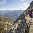
A 600-mile multiuse trail will connect 15 mountain towns in Northern California © Getty Images
Think of epic American landscapes and California often springs to mind, along with its coastal stretches, ancient redwoods, deserts, and postcard-pretty towns. Now, a new trail system aims to unlock some of the state's best views along a 600-mile network of multiuse trails in the northeastern part of the state.
- placement: fullWidth
- path: articles/in-content-top
- possible size: [970, 250], [970, 90], [728, 90], [300, 250], [320, 50], [1, 1],
- targeting:
{
  "url": "lost-sierra-route-trail-california",
  "destination": "California",
  "continent": "North-America",
  "country": "USA",
  "region": "California"
}
You can argue all day about the most scenic spots in California, but the Sierra Nevada mountain range is a strong contender with its national parks, forests and monuments. The Lost Sierra Route aims to highlight these treasures and bring visitors to parts of the Sierras and surrounding regions that are typically off the tourist trail.

The project is known as Connected Communities and is a joint partnership between the nonprofit organization Sierra Buttes Trail Stewardship, and the US Forest Service and community partners. The aim is to revitalize the Sierra Buttes—an alpine region of towns and mountain peaks where the Sierra Nevada meets the Cascades (known as "the Lost Sierra")—through recreation-based industry.
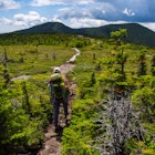
The first phase is expected to launch in 2023 with 20 miles of single-track multiuse trails that will connect the mountain towns of Quincy and Taylorsville with views of the mountain ranges and down into the Indian Valley. The long-term plan is to gradually connect a total of 15 towns in Northern California and a slice of Nevada over the next seven years through 600 miles of trails; giving intrepid adventurers plenty of opportunities for hiking, biking, moto-riding, horse-riding, fishing, wildlife watching and sightseeing.

- placement: fullWidth
- path: articles/in-content-middle
- possible size: [970, 250], [970, 90], [728, 90], [300, 250], [320, 50], [1, 1],
- targeting:
{
  "url": "lost-sierra-route-trail-california",
  "destination": "California",
  "continent": "North-America",
  "country": "USA",
  "region": "California"
}
If you're more of a section hiker you can break it up into pieces, but there are longer, more remote options as well. "It's not necessarily an A-Z trail," Trinity Stirling, project coordinator for Sierra Buttes Trail Stewardship, tells Lonely Planet. "You can hop between different communities and choose your own adventure. You could visit each mountain town and make a 600-mile loop."
Read more: See California’s incredible redwoods from this new sky walk
Establishing 600 miles of trails requires a lot of boots on the ground and the Sierra Buttes Trail Stewardship have turned to local communities to build out their crew and volunteer teams.
"This past year, in 2021, we ran two professional crews and six youth crews, which was huge coming out of 2020 and COVID-19 when we didn't run any youth crews," Stirling tells Lonely Planet. "It was very exciting to have [young people] back out on the trail and see their connection with public land. They're all from the region so they're working on land in their backyard, working on trails that they can use for the rest of their lives."

- placement: native
- path: articles/in-content-native
- possible size: [f, l],
- targeting:
{
  "url": "lost-sierra-route-trail-california",
  "destination": "California",
  "continent": "North-America",
  "country": "USA",
  "region": "California"
}
In recent decades, this part of northeastern California has suffered from economic hardship through the collapse of the logging and mining industry, and most recently through wildfires and pandemic-related closures and job losses. What the Connected Communities Project aims to bring to the region through the Lost Sierra Route is "a vision for a recreation-focused lifestyle through community investment, shared stewardship, economic opportunity, and important new local jobs" and hopefully encourage families to return to the area.
Right now, the teams are working to expand on smaller sections of the trail from the mining and logging routes of the Gold Rush-era mail delivery route, as well as creating new trails that will bring visitors into the mountain towns—whether that's to grab a coffee before setting off on their adventure, get their bike repaired, sit down to a post-hike meal or book accommodation for the night.
YouTube video player
Other towns that will be connected through the route include Truckee, Loyalton, Sierraville, Sierra City, Downieville, Graeagle, Portola, Greenville, Jonesville, Chester, Westwood, and Susanville in the Plumas and Tahoe national forests, as well as Verdi in Nevada.
To follow the project's progress, check out the Sierra Buttes Trail Stewardship's website for the latest updates on environmental reviews and trail planning.
You might also like:
The best of California's amazing hikes
A practical guide to trekking California's John Muir Trail
North America's best national park day hikes
- placement: fullWidth
- path: articles/bottom
- possible size: [970, 250], [970, 90], [728, 90], [300, 250], [320, 50], [1, 1],
- targeting:
{
  "url": "lost-sierra-route-trail-california",
  "destination": "California",
  "continent": "North-America",
  "country": "USA",
  "region": "California"
}
Explore related stories


 HikingReady for a challenge? Try these 10 epic long-distance hikes in the US
Mar 2, 2023 • 7 min read
 CampingLonely Planet’s seasoned hikers pick their top hikes in the Americas
Jul 29, 2022 • 14 min read
 HikingSlow travel and long distance hikes: how to embrace the new outdoor travel trends
Jul 13, 2022 • 8 min read

 HikingWhat are the best hikes in Palm Springs? A new app rewards the adventurous
Mar 17, 2022 • 3 min read
 CampingHow to visit all of California's national parks in one epic road trip
Mar 14, 2022 • 11 min read
